 See this visualization first on the Voronoi app.
Map Explainer: Greenland
This was originally posted on our Voronoi app. Download the app for free on iOS or Android and discover incredible data-driven charts from a variety of trusted sources.
Greenlanders will be voting in parliamentary elections on March 11, 2025, and, while independence isn’t on the ballot this time around, the territory’s population will be choosing leaders who will define the territory’s future at a critical junction in history.
The Danish autonomous territory hasn’t historically been a powerhouse on the world stage, but it has increasingly been thrust into the spotlight in recent years. U.S. President Trump has repeatedly floated the idea of “buying” the territory, and there is growing interest from countries to move in to extract natural resources.
For those who are less familiar with Greenland, here are a few things to know.
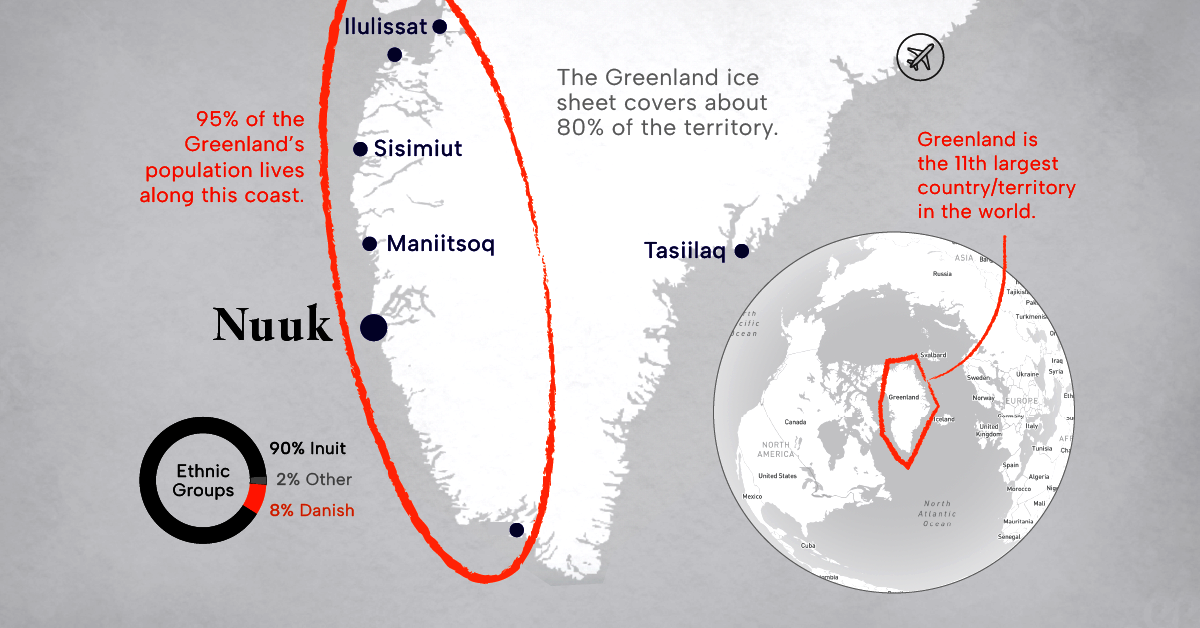
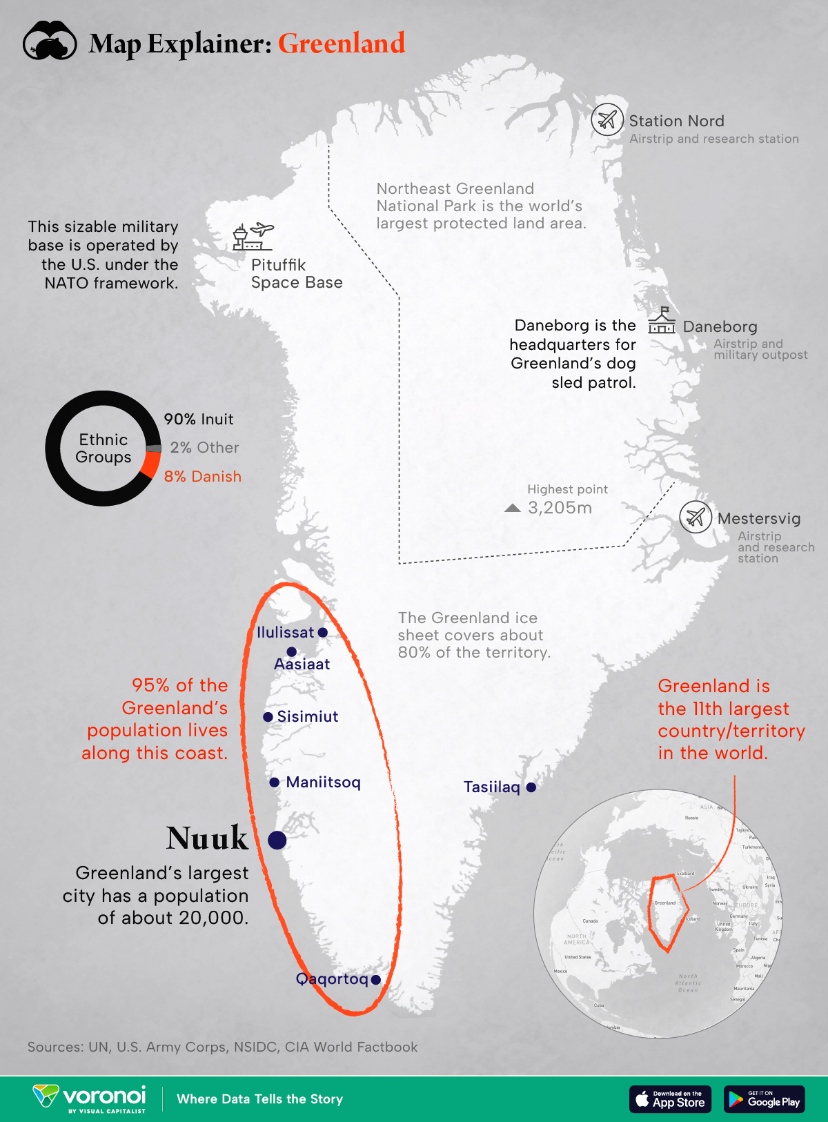
Greenland is Large in Size, Small in Population
Greenland isn’t as massive as it appears in common map projections, but it’s still big. The territory is the 11th largest in the world, around the same size as Saudi Arabia.
Most of the territory’s 56,000 people live along the southwest coast, adjacent to Canada. Nuuk is the largest city with a population of 20,000 people. The vast majority of people on the island are Inuit, with a small minority of Danish inhabitants.
Greenland Isn’t Very Green
Around 80% of Greenland—the whole center of the island—is covered by the Greenland Ice Sheet.
At its thickest point, ice sheet measures almost 2 miles (3 km) in depth, making it the largest concentration of ice in the Northern Hemisphere. Earth’s sea level would rise over 24 feet (7 m) if the Greenland Ice Sheet ever fully melted.
Greenland is Strategically Important, but Lightly Defended
The island’s location between North America and Europe makes it an important geopolitical location. During WWII, Greenland was dotted with military installations. Today, Denmark only maintains small outposts, many of which now serve more research purposes than military.
Of note is the Daneborg base on the east coast of the island. This base serves as the headquarters for Denmark’s Sirius Dog Sled Patrol. The patrol was originally set up to deter German activity in WWII, but today it helps police the Northeast Greenland National Park (the world’s largest protected land area). Aside from Daneborg, there are a couple of other small air strips on the eastern coast.
Over on the northwest coast of the island is the Pituffik Space Base, which is operated by the United States. The base is the northernmost installation of the U.S. Armed Forces, and is home to air force infrastructure, as well as missile early warning systems and space surveillance systems.
As Russia and NATO countries continue to compete for control and influence in the Arctic, Greenland becomes even more important from a strategic standpoint. The increasing accessibility of the Arctic due to climate change further amplifies its significance, with potential shipping routes and resource extraction becoming more viable.
The post Map Explainer: Greenland appeared first on Visual Capitalist.