Meteorologists believe a developing “super El Niño” could have profound effects on crops around the world this growing season.
The European Centre for Medium-Range Weather Forecasts (ECMWF) recently issued its prediction for sea surface temperature anomalies for the next seven months.
The organization’s Nino Plumes chart raised a lot of eyebrows in the weather-watching world.
WHY IT MATTERS: El Niño could dictate global growing-season weather conditions.
“It is suggesting one of the strongest El Niño events on record, which will likely top the 1982 and 1997 events,” Eric Snodgrass, Nutrien Ag Solution’s principal atmospheric scientist, said in a recent YouTube video.
The model shows that sea surface temperatures could be about 2.5 C higher than normal by the end of the forecast period, indicating an “eye-popping” El Niño weather event is on the way.
“I’ll be honest, when I looked at it, I said, ‘you’ve got to be kidding me’,” said Snodgrass in another YouTube video.
Snodgrass is quick to point out that spring forecasts of El Niño events are notorious for missing the mark. For instance, in the spring of 2017, the ECMWF forecast a moderate El Niño event later that summer, but it never materialized.
He’s not suggesting that will happen this time around. In fact, westerly wind bursts and Pacific trade winds suggest a high probability of a rapid transition to El Niño this year.
However, it is an important reminder that spring El Niño forecasts don’t always get it right. If the ECMWF forecast is accurate, it will have ramifications for farmers globally.
Global ramifications
It could usher in a “mega-drought” for growers in Indonesia, India and parts of Australia.
On the other side of the globe, it’s a different story.
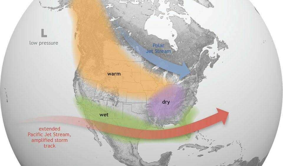
Whenever a forecast calls for excessive surface heating of the Pacific Ocean, it tends to dump the excess moisture evaporating off the ocean into the middle of North America and South America.
That is exactly what happened in the strong El Niño analog years of 1972, 1982, 1991, 1997 and 2015, starting in spring and running through the summer months.
That could be a huge help for Brazil’s safrinha corn crop and could lead to a “moisture revival” in the drought-stricken regions of the U.S. Plains.
The downside is that there could be a weak southwest monsoon in India and “bone dry” conditions in the North China Plain and Manchurian Plain.
Bruce Burnett, markets desk analyst for The Western Producer, said the ECMWF is the gold standard for medium range-weather forecasts.
However, he thinks the timing of El Niño’s influence is more important than the event’s relative strength, noting that other weather models suggest it will arrive later in the year.
Timing matters
For instance, the National Oceanic and Atmospheric Administration in the United States believes conditions will be ENSO-neutral in the May through July period, with El Niño likely arriving in the June through August period and persisting through the end of 2026.
Burnett expects El Niño to have the biggest impact on countries surrounding the central Pacific, where the waters are warming.
El Nino later this year,
but they are quick to point out that spring forecasts of El Nino events are notorious for missing the mark.
Illustration: USA Today Network via Reuters
Indonesia’s palm crop will likely be hurt, but it is a perennial crop, not an annual, so the impact on yields will be somewhat delayed.
It could reduce India’s southwest monsoon, which is active from June through September. That would hurt the rabi crop that goes in the ground following the end of the monsoon season.
It would have no impact on the current rabi crop that is just starting to be harvested.
India can be a major importer or exporter of wheat at times, but it grows and consumes a different type of wheat than Canada produces.
It is one of the top importers of Canadian peas and lentils and a poor rabi pulse harvest next year could boost sales of those two crops in 2026-27.
Yield impacts
Australia is planting its winter wheat crop right now. A quick transition to El Niño could result in a dry winter and early spring in that country.
“That will definitely hurt production prospects,” said Burnett.
He agrees with Snodgrass that the U.S. tends to be wetter, which could boost corn, soybean and wheat yields in that country, depending on when El Niño arrives.
Burnett believes it will be touch-and-go for Brazil’s safrinha corn crop, which will be harvested in the next month or two.
“If (El Niño) is going to appear, it needs to appear damn fast,” he said.
Snodgrass said the North American Multi-Model Ensemble (NMME) forecast is similar to the ECMWF forecast, though it calls for notably drier conditions across the European Union and the Black Sea region.
The NMME model also forecasts a drier bias for most of the U.S. corn belt, but agrees that the Plains region should benefit from improved moisture conditions.
The NMME is not as aggressively dry as the ECMWF model for China.
The post ‘Eye-popping’ El Nino possible appeared first on Farmtario.


