Wildfire smoke limited irradiance across southern and western Ontario and the Great Lakes in mid-July, offsetting otherwise favourable high-pressure conditions. During 10-21 July, GHI around the Great lakes and down into the US Northeast were up to 10% below average. A majority of this loss
was due to the reduced clear sky irradiance which was down over 6% in areas, according to analysis using the Solcast API.
The muted irradiance result followed a rapid increase in wildfire activity across northern and north-western Ontario. More than 100 fires were active by mid-July, later rising above 180, as Ontario’s firedanger reached “extreme”. Smoke travelled south-east across southern Ontario and Quebec before extending into the US Midwest and Northeast. Toronto, Chicago, Detroit and Minneapolis recorded some of the world’s poorest air quality during 14–17 July, while alerts were issued across more than 20 US states.
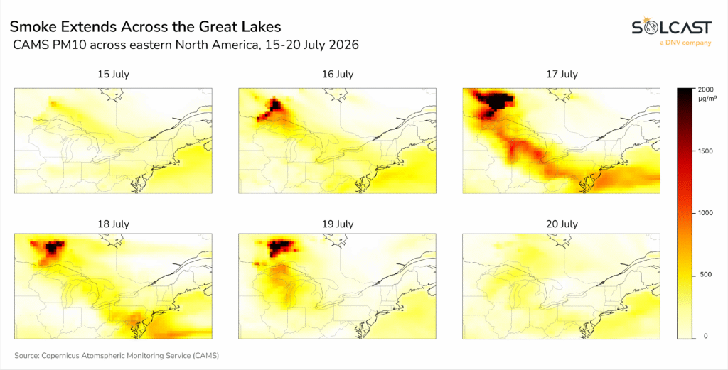
Particulate matter data (Copernicus/CAMS PM10) showed the smoke extending well beyond the source of the fires on 17 July. The highest particulate concentrations were located over north-western Ontario, with elevated particulates continuing south-east across the Great Lakes and towards the US Northeast.
The smoke is most clearly visible in the clear-sky irradiance anomaly, where aerosols reduced the available solar resource before cloud impacts are considered. The observed GHI anomaly shows a similar reduction in irradiance across the Great Lakes and down the US East Coast during the peak of the smoke event.
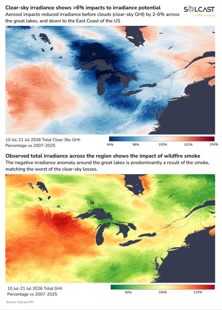
The smoke is most clearly visible in the clear-sky irradiance anomaly, where aerosols reduced the available solar resource before cloud impacts are considered. The observed GHI anomaly shows a similar reduction in irradiance across the Great Lakes and down the US East Coast during the peak of the smoke event.
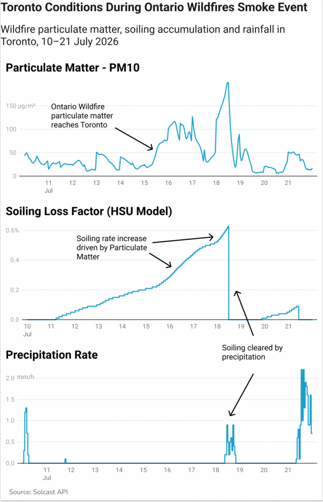
Within the smoke corridor, particulate (PM10) concentrations over Toronto and southern Ontario remained relatively stable during 1–14 July, before increasing abruptly on 15 July and reaching around three times the earlier July baseline during 16–18 July. Concentrations then declined by 19–20 July. Closer to the fires in north-western Ontario, particulates reached approximately eight times its pre-event baseline on 17 July. These airborne particles attenuated incoming sunlight even where cloud cover was limited, reducing actual GHI relative to the available clear-sky resource.
The combination of elevated particulates and rain-free conditions exacerbated soiling losses. Soiling accumulation increased due to the smoke particulate, increasing losses rapidly, and were not cleared until much needed rainfall on the 18th July.
Solcast produces these figures by tracking clouds and aerosols at 1-2km resolution globally, using satellite data and proprietary AI/ML algorithms. This data is used to drive irradiance models, enabling Solcast to calculate irradiance at high resolution, with typical bias of less than 2%, and also cloud-tracking forecasts. This data is used by more than 350 companies managing over 300 GW of solar assets globally.
The post Ontario wildfire smoke suppresses irradiance across the Great Lakes appeared first on pv magazine Global.