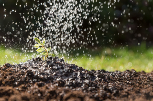
Farming has always been a delicate balance between nature and human effort. Too much water, and crops suffer; too little, and yields decline. The same goes for fertilization — getting it just right is key. But with shifting weather patterns and unpredictable soil conditions, how can farmers make the best decisions?
That’s where satellites come in. By capturing detailed images and data from above, they provide farmers with real-time insights into soil moisture, plant health, and nutrient levels. This means smarter irrigation, more precise fertilization, and ultimately, healthier crops with less waste. More and more growers are beginning to practise satellite imagery in agriculture, using this technology to optimize field management and improve sustainability. As technology reshapes the industry, satellite images for agriculture are becoming an essential tool for feeding a growing world while protecting the land we depend on.
Irrigation Challenges in Agriculture
Irrigation is essential for modern farming, but it comes with its own set of challenges. One of the biggest issues is inefficiency — without precise control, water can be over-applied, leading to runoff, soil erosion, and nutrient loss. On the other hand, under-irrigation leaves crops stressed, reducing yields and profitability.
Another challenge is water scarcity. In many regions, freshwater resources are becoming increasingly limited due to climate change and growing agricultural demand. Farmers must find ways to maximize every drop while ensuring long-term soil health. Poor irrigation management can also contribute to salinization, where excess minerals build up in the soil, making it less fertile over time.
Balancing water use with crop needs is a constant struggle. Without accurate data on soil moisture and weather conditions, irrigation decisions are often based on guesswork rather than science. This is where satellite technology is starting to change the game, offering a smarter way to manage water use and improve agricultural sustainability.
Irrigation with Satellite Data
Unlike traditional irrigation methods, which often rely on fixed schedules or visual field inspections, satellite technology provides continuous, large-scale monitoring, ensuring that water is applied exactly where and when it is needed. This reduces unnecessary water use, prevents over-irrigation, and minimizes the risk of soil erosion caused by excessive runoff.
One of the biggest advantages of this approach is precision. Instead of watering entire fields evenly — wasting resources on areas that already have adequate moisture — farmers can target only the zones that require attention, improving efficiency and reducing costs. Satellite images used for agriculture also play a crucial role in early drought detection, identifying water stress in crops before visible symptoms appear. This allows farmers to make proactive adjustments, such as altering irrigation schedules or implementing water conservation techniques, to prevent significant yield losses.
Additionally, satellite data provides historical insights that help track long-term moisture trends, allowing farmers to anticipate seasonal changes and optimize their irrigation strategies accordingly. By integrating this data with predictive models and weather forecasts, farmers can refine their approach to water management, improving resilience against unpredictable climate patterns.
Beyond efficiency, satellites are key to advancing sustainable agricultural practices. With growing concerns over water scarcity and soil degradation, optimizing irrigation through data-driven insights is essential for long-term food security. By reducing excessive water use and preventing soil depletion, satellite technology helps ensure that farmland remains productive for future generations. As climate change continues to challenge traditional farming methods, leveraging satellite insights will not only enhance efficiency but also strengthen agriculture’s ability to adapt and thrive in an increasingly unpredictable world.
Fertilization Challenges in Agriculture
Fertilization is essential for healthy crop growth, but applying it correctly is more complex than it seems. One of the biggest challenges is imbalance — too much fertilizer can harm plants, degrade soil health, and contaminate water sources, while too little can lead to weak crops and lower yields. Finding the right balance requires an understanding of soil composition, nutrient availability, and crop needs, which isn’t always easy without the right data.
Another issue is nutrient loss. Rainfall and irrigation can wash fertilizers away before plants absorb them, leading to wasted resources and pollution in nearby rivers and lakes. Over time, excessive fertilization can also contribute to soil degradation, reducing its long-term productivity.
Without precise application methods, fertilization remains a guessing game for many farmers. The challenge is to maximize plant nutrition while minimizing environmental harm — something that advanced technology, including satellite data, is now helping to improve.
Fertilization with Satellite Data
Fertilization is most effective when it delivers the right nutrients to the right areas at the right time. Satellite data is transforming this process by providing farmers with detailed insights into soil conditions and crop health. Instead of applying fertilizers uniformly across a field, farmers can now target specific areas that need them most, reducing waste and improving efficiency.
One of the biggest advantages of high-resolution satellite imagery is its ability to detect nutrient deficiencies before they become visible to the human eye. By analyzing variations in plant health, satellites help farmers pinpoint areas where additional fertilization is needed, ensuring crops receive the right balance of nutrients. This precision approach not only boosts yields but also prevents excessive fertilizer use, reducing runoff that can harm surrounding ecosystems.
Satellite data is also crucial for long-term soil management. By tracking changes over time, farmers can adjust fertilization strategies based on evolving soil conditions, ensuring sustainable productivity. As technology continues to evolve, satellite-driven fertilization will become an even more essential tool in improving crop health while minimizing environmental impact.
Perspectives
The future of agriculture lies in precision. As water resources become scarcer and soil health faces increasing challenges, the need for smarter irrigation and fertilization strategies is greater than ever. Technology will continue to drive this transformation, helping farmers apply water and nutrients exactly where and when they are needed.
Satellites will play a key role in this evolution. With advancements in real-time high resolution satellite images, farmers will gain even sharper insights into field conditions, enabling them to make data-driven decisions with unprecedented accuracy. From detecting moisture levels to identifying nutrient deficiencies, satellite technology will help optimize every aspect of crop management.
As these innovations progress, the goal is clear: higher yields, reduced waste, and more sustainable farming practices. With satellite-driven precision agriculture, farmers can not only meet the demands of a growing population but also protect the land for generations to come.
The post Smart Farming: Using Satellite Insights for Better Irrigation and Fertilization appeared first on Green.org.


