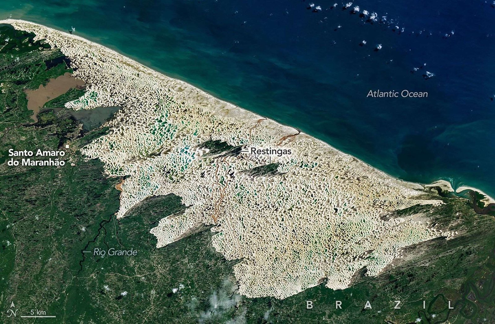
The coastal dune system in Lençóis Maranhenses National Park in northeastern Brazil is among the most surreal landscapes on Earth. At first glance, the park looks like a desert, but it is far from it. This place receives about 125 centimeters (50 inches) of rain per year—slightly more than Seattle and double what falls in London.
The result is a paradox: rows of sparkling white quartz dunes, some rising 30 meters (100 feet), soar over a mosaic of blue and green freshwater lagoons. The park’s name stems from the Portuguese word lençóis, meaning “bedsheets,” a reference that makes the most sense when the park is viewed from afar. From that perspective, the sweeping curves of the largest coastal dune field in South America resemble a rumpled, white bedsheet.
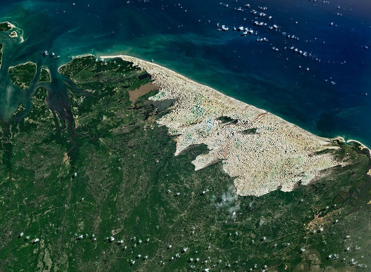
These Landsat 9 images were captured in June 2026, around the time when lagoon water levels typically peak. The partially impermeable layer of bedrock and clay beneath the sand prevents the lagoons from draining during the wet season. However, as rains subside between August and November, the water table falls, and by December, most of the lagoons dry up.
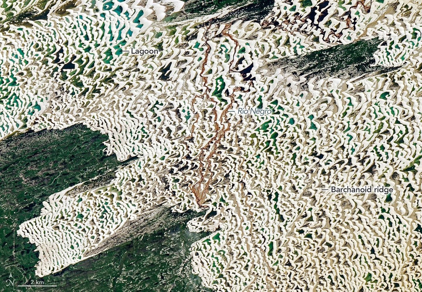
The dune field, a tan area within an expanse of green, is the centerpiece of the park. It spans about 900 square kilometers (350 square miles), roughly the size of New York City. From above, shallower lagoons appear light blue, often taking on turquoise or aquamarine hues as sunlight reflects off the sand below. Deeper lagoons are darker, a result of the deeper water absorbing more red, yellow, and green wavelengths, leaving mostly blue light to scatter back. Suspended sediment, microscopic algae, and dissolved organic matter also contribute to the array of colors, giving some lagoons greener and browner tones.
Green vegetation surrounds the dune field, which sits at the intersection of three Brazilian biomes: the Amazon rainforest to the west, the tropical wooded savannas of the Cerrado to the south, and the dry shrublands and thorn forests of the Caatinga to the east. Closest to the dunes are mangroves and restinga forests, ecosystems well adapted to sandy, coastal soils.
The dune field exists because of the rare convergence of geologic and climatic conditions. Rivers, including the Mearim and Parnaíba, deliver the key ingredient—quartz sand—to this unusually flat portion of the Maranhão coastline in massive quantities. It has accumulated here over the past few hundred thousand years driven in part by fluctuating sea levels and shoreline transgression and regression. Persistent easterly trade winds have also played a critical role. During the dry season, winds often reach at least 50 kilometers per hour, fast enough to build the dunes and push them westward at a pace of roughly 4 to 25 meters per year. That is fast for sand dunes, though not the fastest in the world. Satellites have tracked small barchan dunes in Namibia’s Sperrgebiet region moving at rates exceeding 80 meters per year.
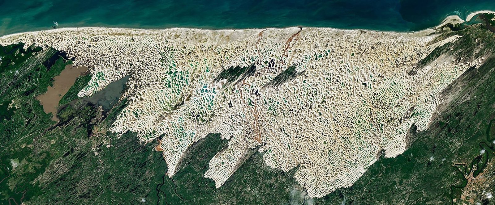
Landsat images, meanwhile, show the dune field at Lençóis Maranhenses has extended westward by about 0.5 kilometers between 1986 and 2026 in some areas due to the conveyor belt of dunes running inland from the coastline. The nearly constant movement of sand prevents vegetation from becoming established across much of the dune field.
UNESCO declared the park a World Heritage site in 2024, citing its remarkable geology and rich biodiversity. The park is home to more than 850 documented species, including fish, birds, reptiles, mammals, and phytoplankton. Among them are four endangered species, including the neotropical otter, West Indian manatee, scarlet ibis, and oncilla (a type of wild cat). Among the lagoons’ most remarkable inhabitants are the trahira (Hoplias malabaricus), a predatory fish species with large canine-like teeth. During the dry season, it burrows far enough under the sand to find damp mud, where it enters a dormant state, emerging after the rains to hunt insects and other fish.
NASA Earth Observatory images by Michala Garrison, using Landsat data from the U.S. Geological Survey. Story by Adam Voiland.
References & Resources
- Atlas Obscura (2020, July 16) The Brazilian Desert That Turns Into a Thousand Lagoons. Accessed August 4, 2026.
- C.M. de M. Luna, M. (2011) Model for the genesis of coastal dune fields with vegetation. Geomorphology, 129(3-4), 215-224.
- CNN (2022, March 9) The unknown and otherworldly landscape of Brazil’s Lençóis Maranhenses National Park. Accessed August 4, 2026.
- Global Alliance of National Park (2026) Lencois Maranhenses National Park. Accessed August 4, 2026.
- Google Arts & Culture Lençóis Maranhenses National Park, Brazil. Accessed August 4, 2026.
- Luís Silva dos Santos, A., et al. (2019) Modelling Dunes from Lençóis Maranhenses National Park (Brazil): Largest dune field in South America. Scientific Reports, 9(7434).
- Marques, M., et al. (2015) Coastal plain forests in southern and southeastern Brazil: ecological drivers, floristic patterns and conservation status. Brazilian Journal of Botany, 38, 1–18.
- Miranda, J.P., et al., (2012) Reptiles from Lençóis Maranhenses National Park, Maranhão, northeastern Brazil. ZooKeys, 246, 51-68.
- National Geographic (2010, July) A Sea of Dunes. Accessed August 4, 2026.
- Parteli, E.J.R. (2021) Profile measurement and simulation of a transverse dune field in the Lençóis Maranhenses. Accessed August 4, 2026.
- Revista pesquisa fapesp (2013) The secrets of the Lençóis Maranhenses. Accessed August 4, 2026.
- Smithsonian Magazine (2014, June 20) How Do Thousands of Clear Blue Lagoons End Up In These Brazilian Sand Dunes? Accessed August 4, 2026.
- UNESCO (2024) Lençóis Maranhenses National Park. Accessed August 4, 2026.
You may also be interested in:
Stay up-to-date with the latest content from NASA as we explore the universe and discover more about our home planet.
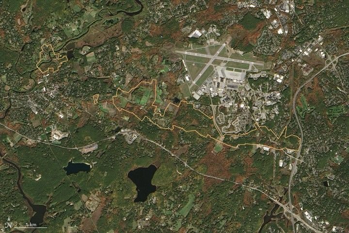
Sites relevant to the start of the American Revolutionary War are interspersed throughout the modern-day Boston metropolitan region.
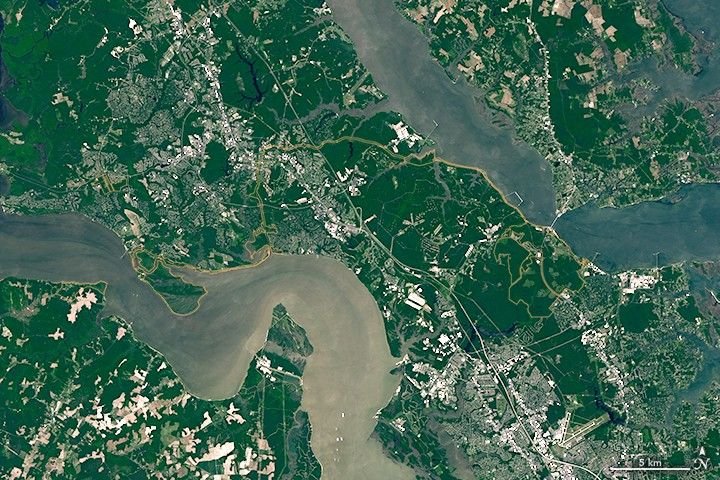
The colonial communities of “America’s historic triangle” played defining roles in the road to American independence.
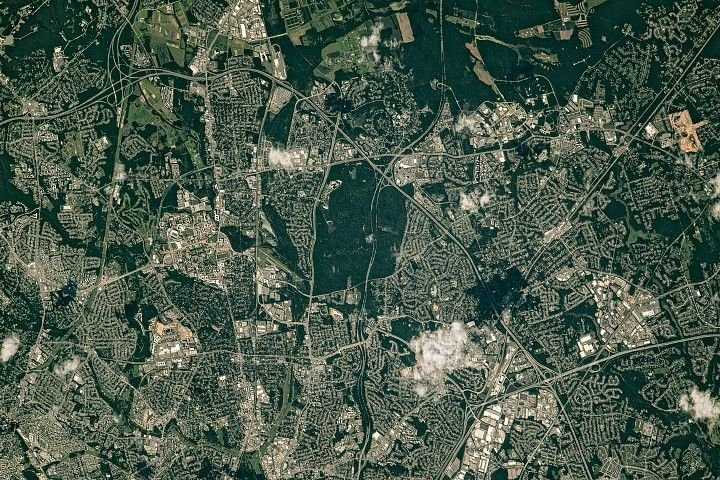
Along the northeast side of the Capital Beltway in Maryland, green spaces weave through the developed landscape.